
Roero: Wild land.
Between the hydro left bank of the Tanaro River and the Carmagnolese plain we find the territory of Roero, a favorite land for the vine since ancient Roman times.
Until about 500,000 years ago, during the Pliocene, the entire Po Valley plain was submerged by the “Gulf of Padano”: an ancient sea the sign with shallow dephts, which left substantial deposits of sand, clay and mineral salts and a large deposit of marine fossils that can still be found in these lands. Between 500,000 and 250,000 years ago the tectonic thrust of the African plate on the Euro-asiatic’s one brought out the gulf floor, and a new land emerged: the Padana plain, which today takes its way to the maritime Alps, to the Adriatic Sea to the east.

In the front of the Maritime Alps, to the west, the territory of Langhe and Roero, the crackling from the Tanaro River, which flows from west to east, defining the north of the Langhe and south of the Roero.
The formation of the Roero is “recent” history ” compared to that of the Padana plain: it seems that this steep hills born from a phenomenon erosion by the Tanaro River, which diverting its course about 60,000 years ago drew the beautiful hilly landscape of this area.
The erosion caused by the so-called “Capture of the Tanaro” phenomenon removed quantities of soil, giving rise to the “Rocche del Roero”, deep rifts in the hills visible in part of the Roero’s territory, and resurfaced the most ancient soil layers, formed during the geological eras, in aging an extremely heterogeneous diattine of soils.
The landscape of roero is the landscape of the Roero aroused by the acfield from the prologio to the various and wild prolusion: these are the reasons for the constant erosion by the weather, and preserve the biodiversity and the anointic of here’s beautiful territory.
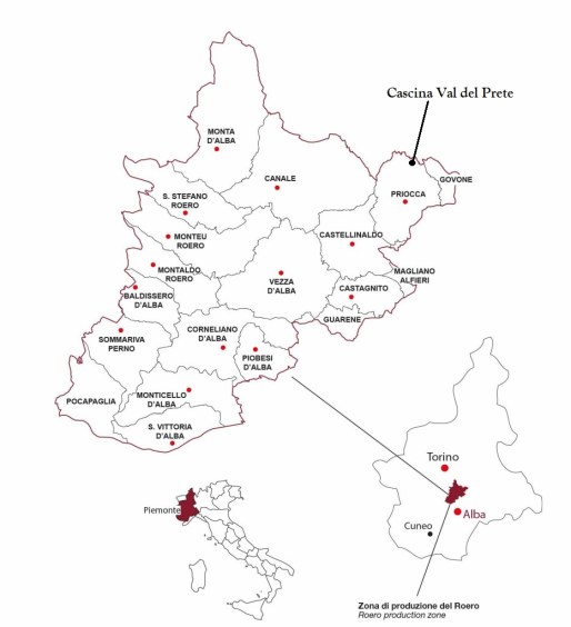
In 2013, the producers of the area decided to found the consortium of protection of Roero, an association of wine producers in D.O.C.G. Roero. The consortium soon drew up the map of the designation, highlighting the MGA (condirective mentions) that underline the areas particularly suited to the viticulture.

The winery is located in the municipality of Priocca, on the northwest border of the Roero’s D.O.C.G. denomination, and part of the province of Cuneo. Here the grounds are less sandy than the rest of the Roero’s territory, the soil composition are mostly rich of clayey and calcareous that tipes of soil make wines with more structure property.
